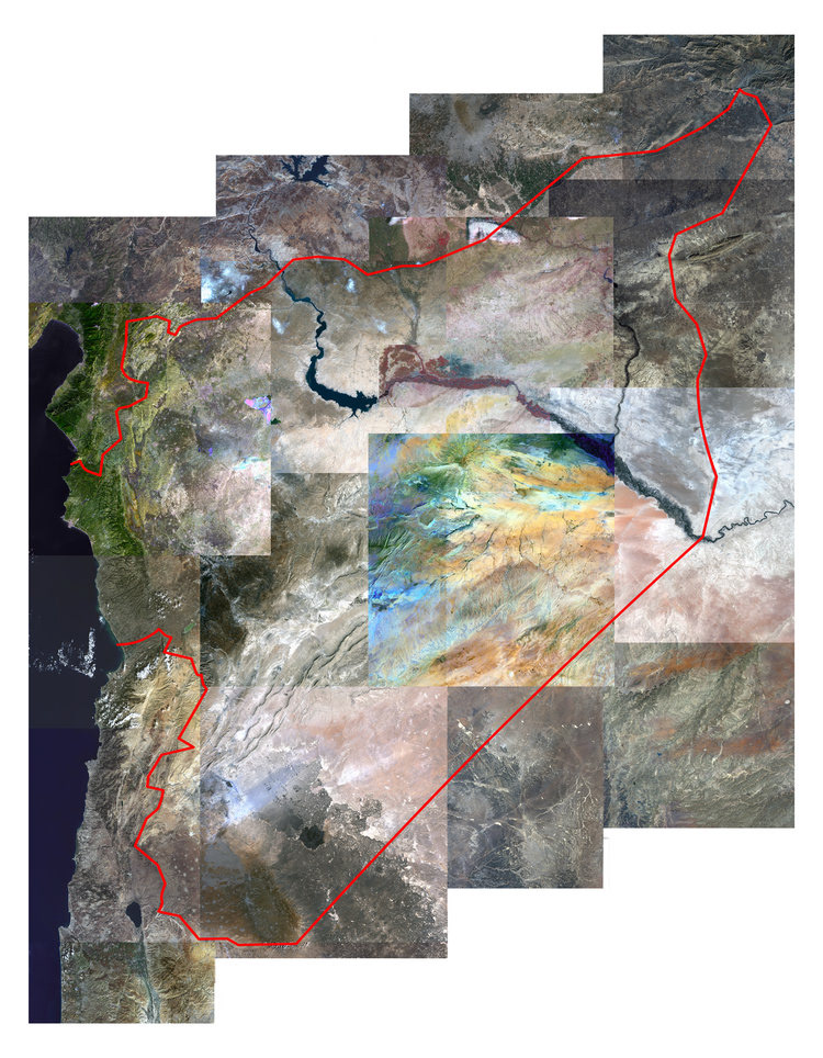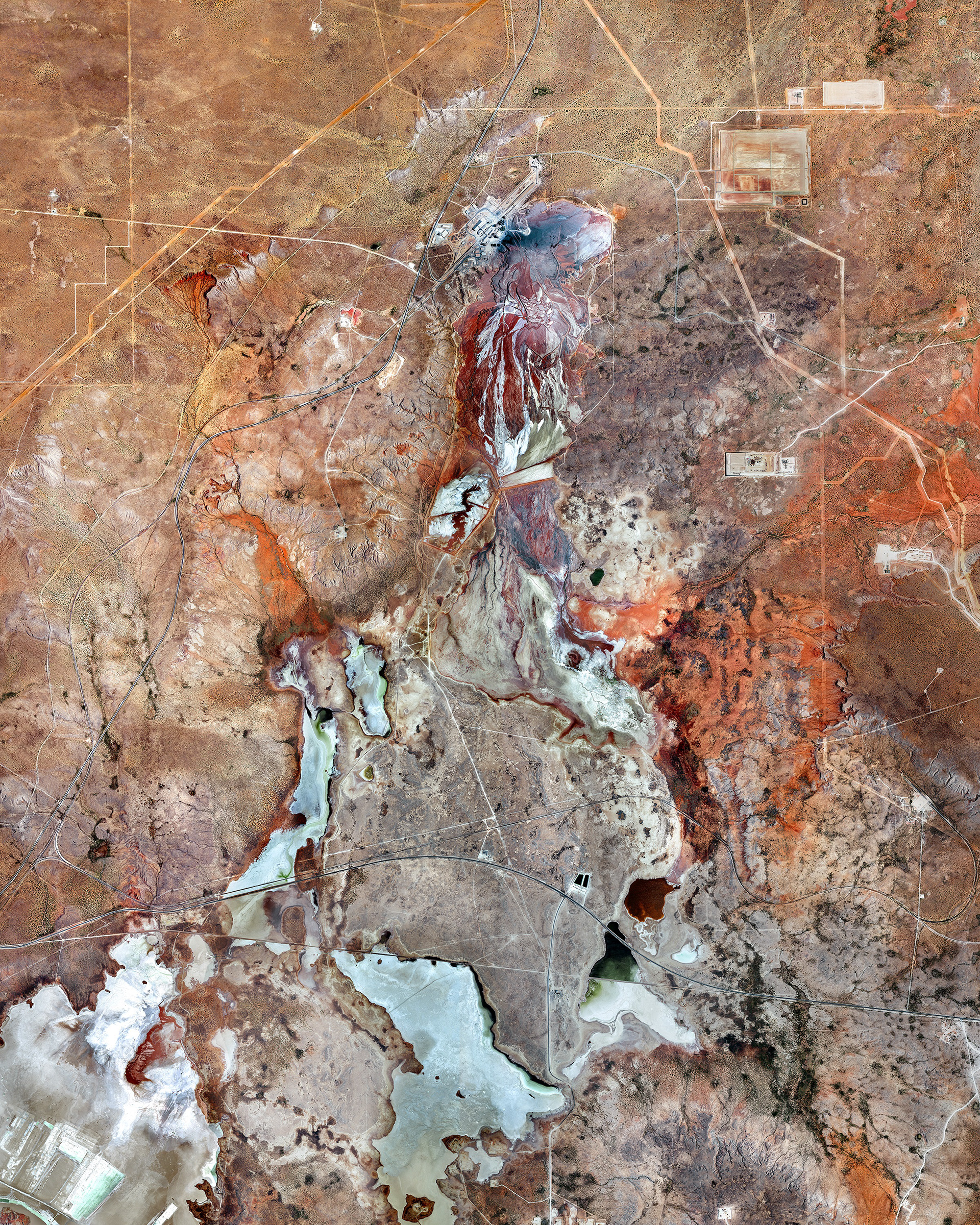
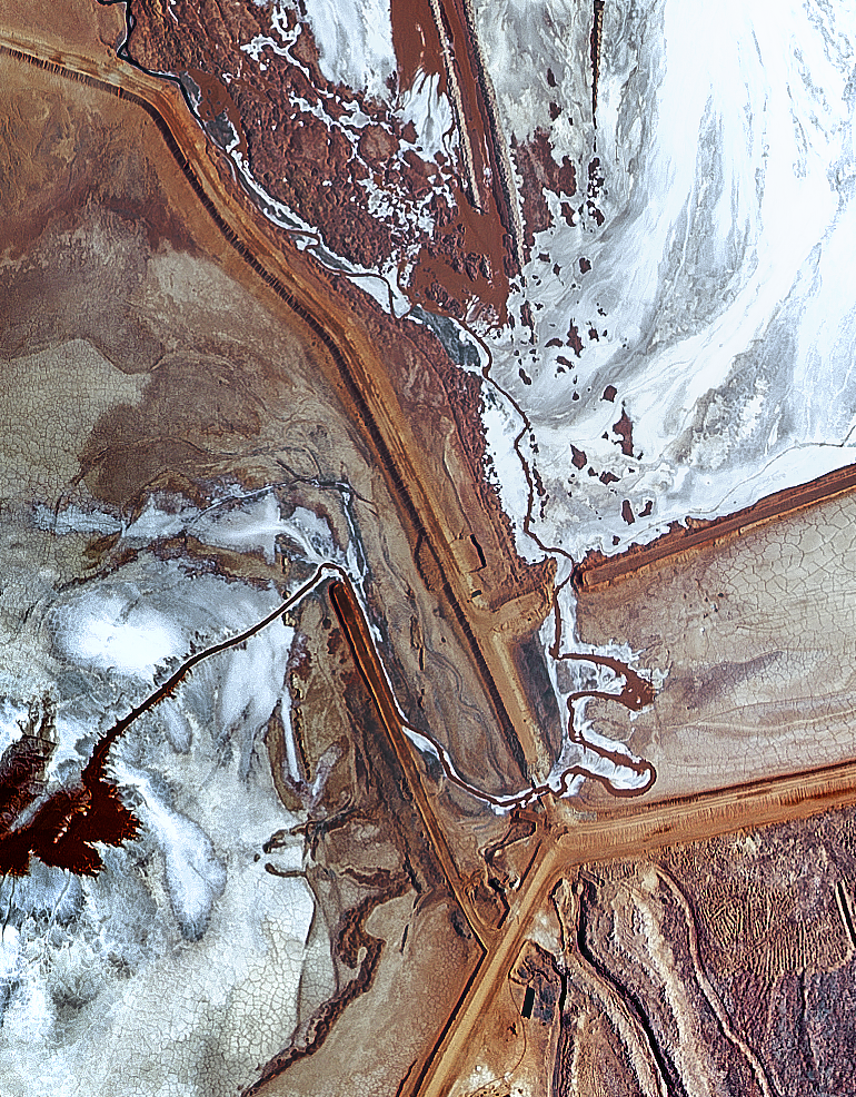
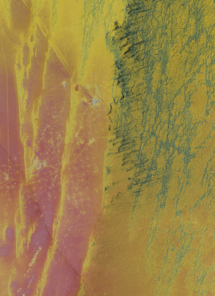
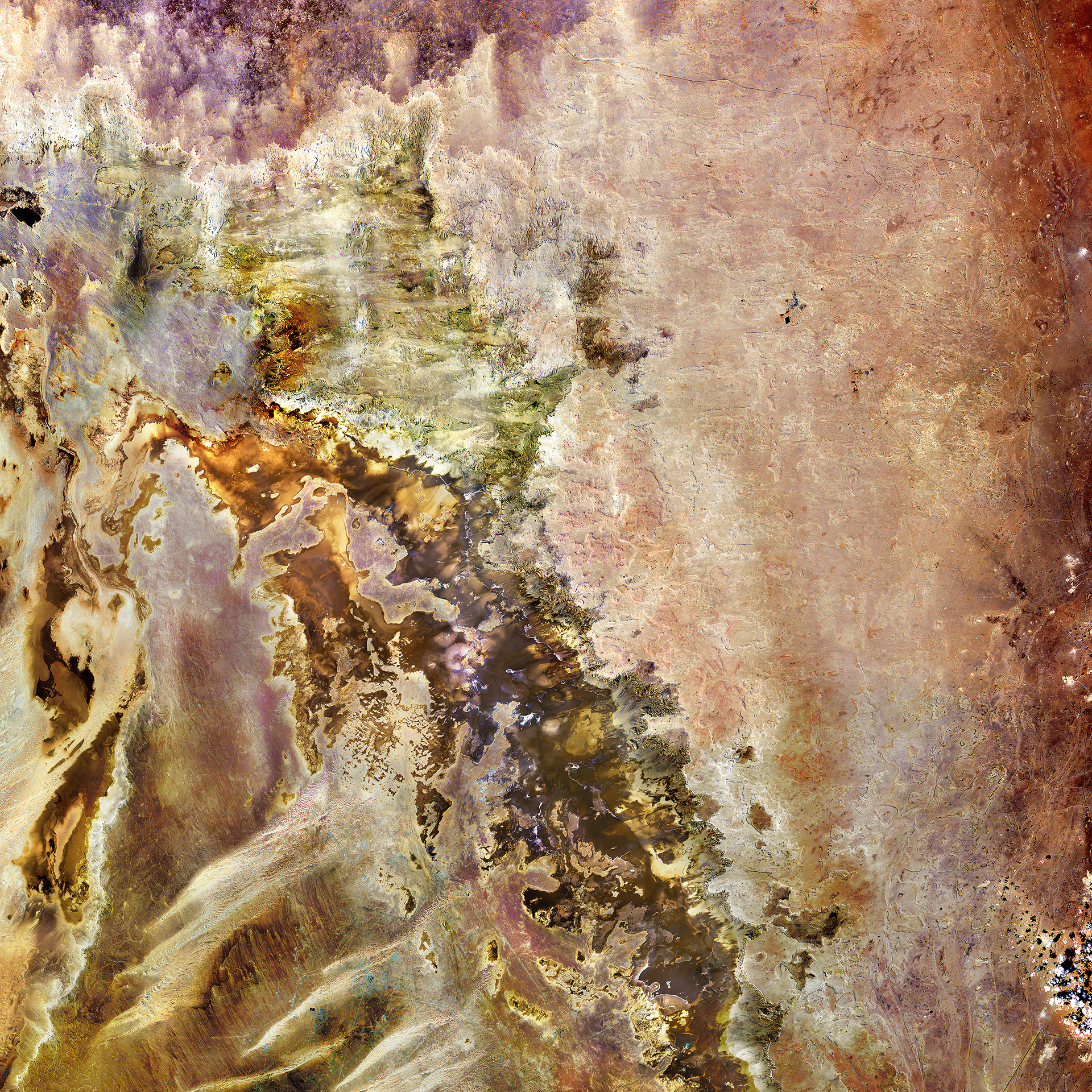
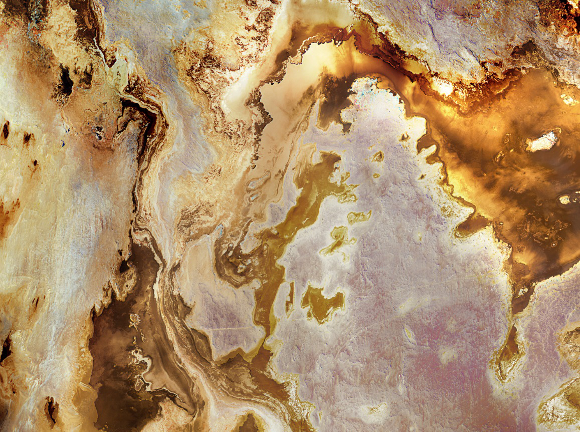
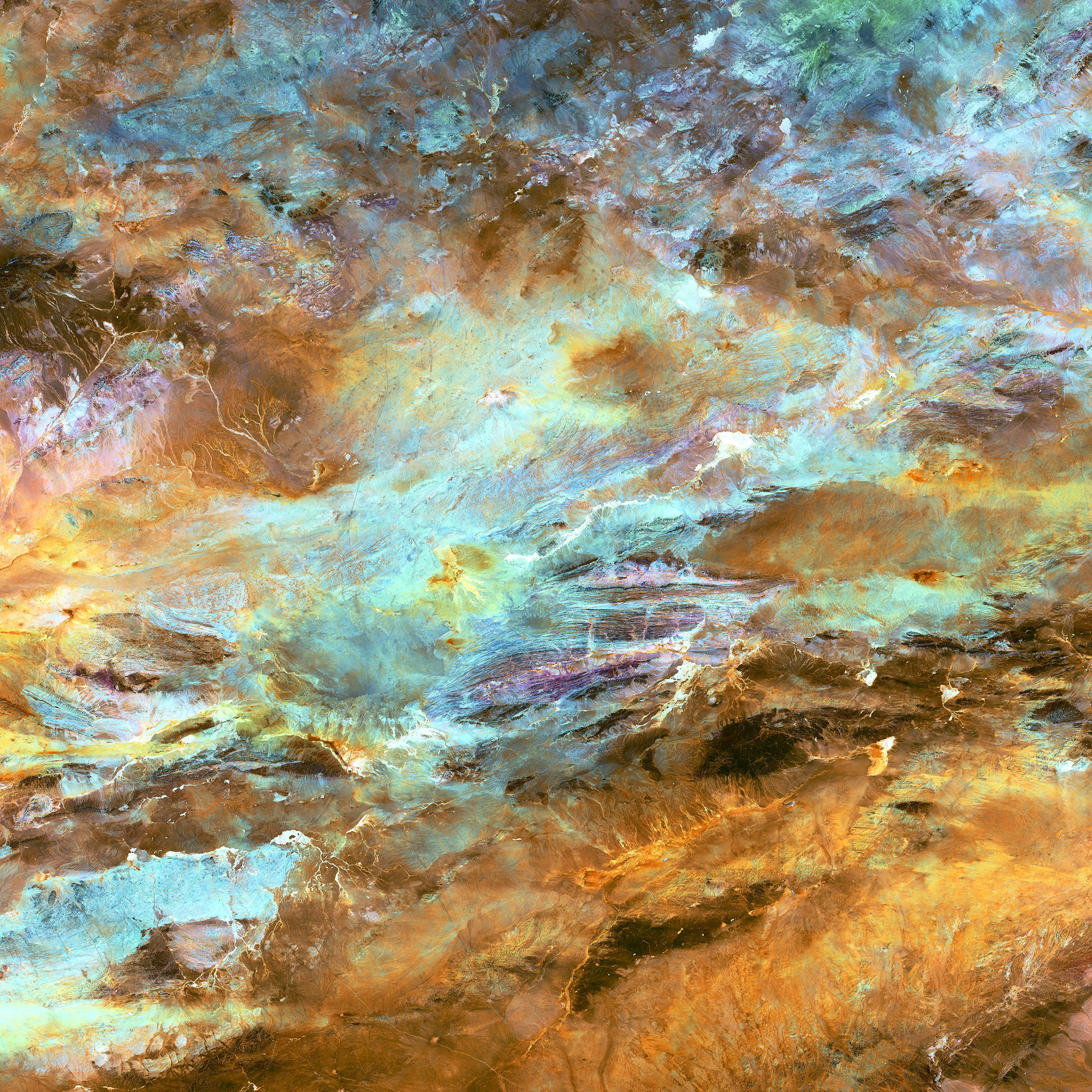
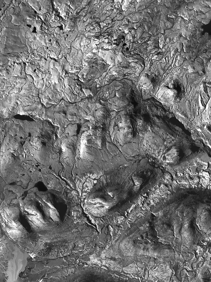
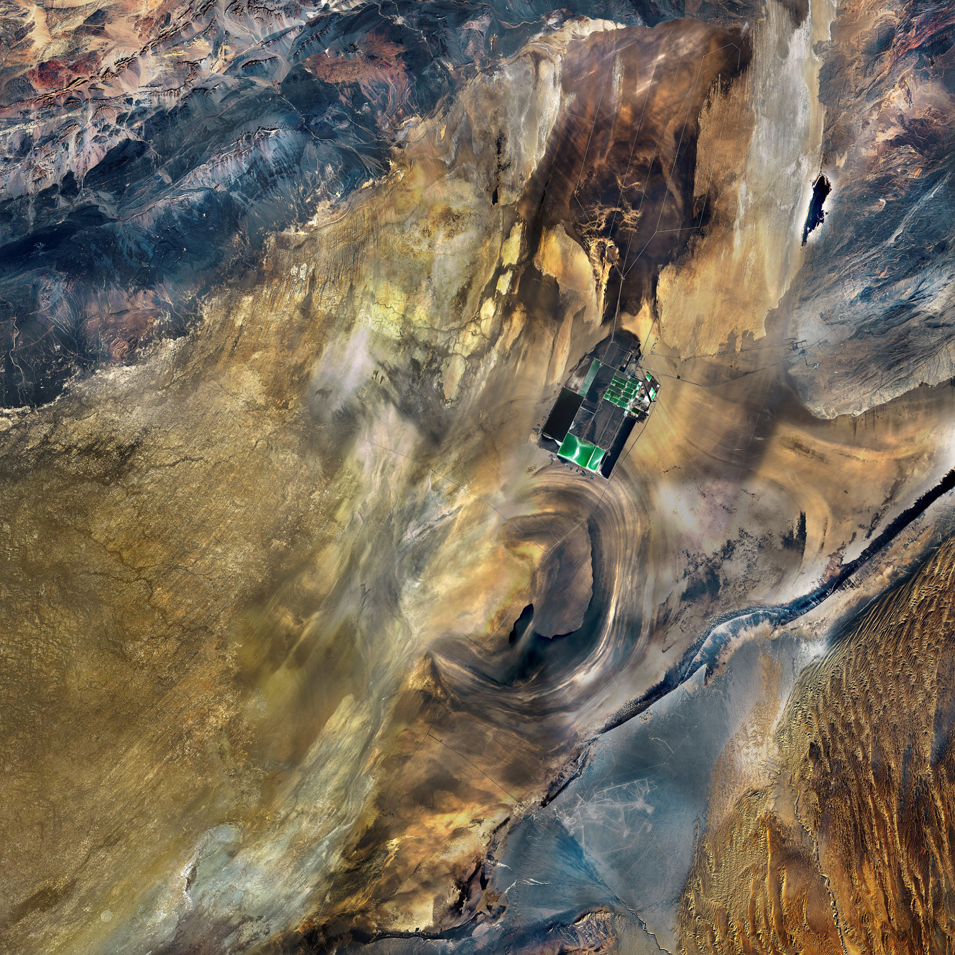
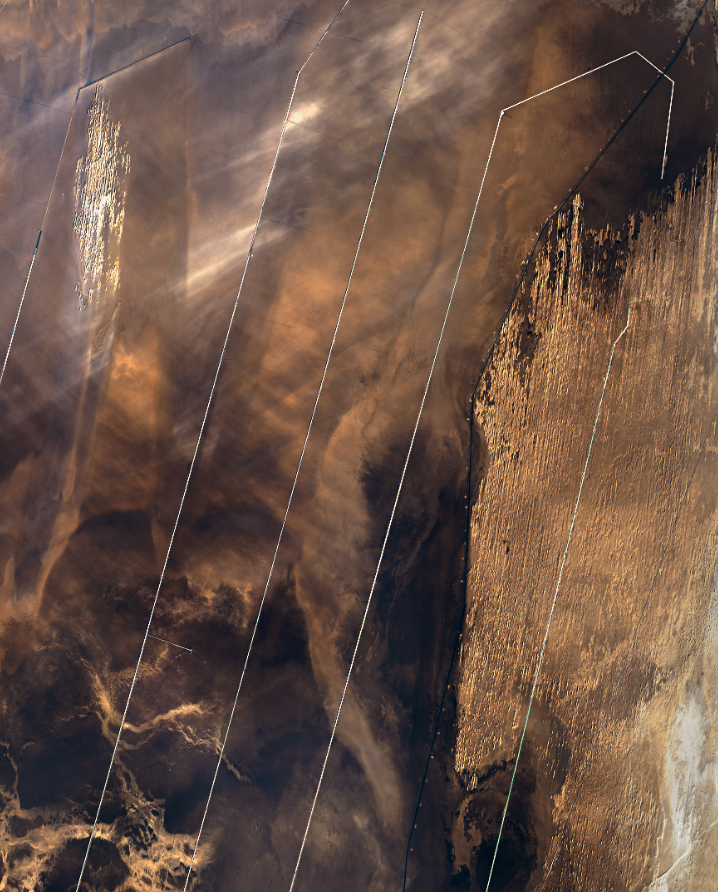
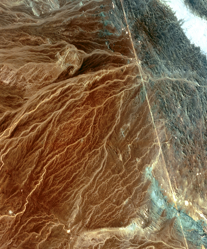
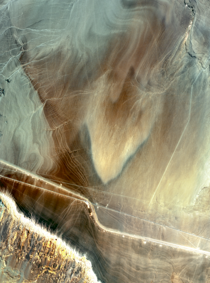
Potash Mine, Carlsbad, New Mexico
64x80” Collaged Aerial Images
2023
As an essential soil nutrient, potassium is vital for global food production.
The US reached peak potash production in 1968 with the top 5 producing
countries likely to reach peak production by 2050. Due to this expected
scarcity, it has been argued that global economic development may be
drastically reduced as potash becomes harder to mine. This image combines
four aerial images stitched together with colors enhanced to highlight the
breadth of the mine.
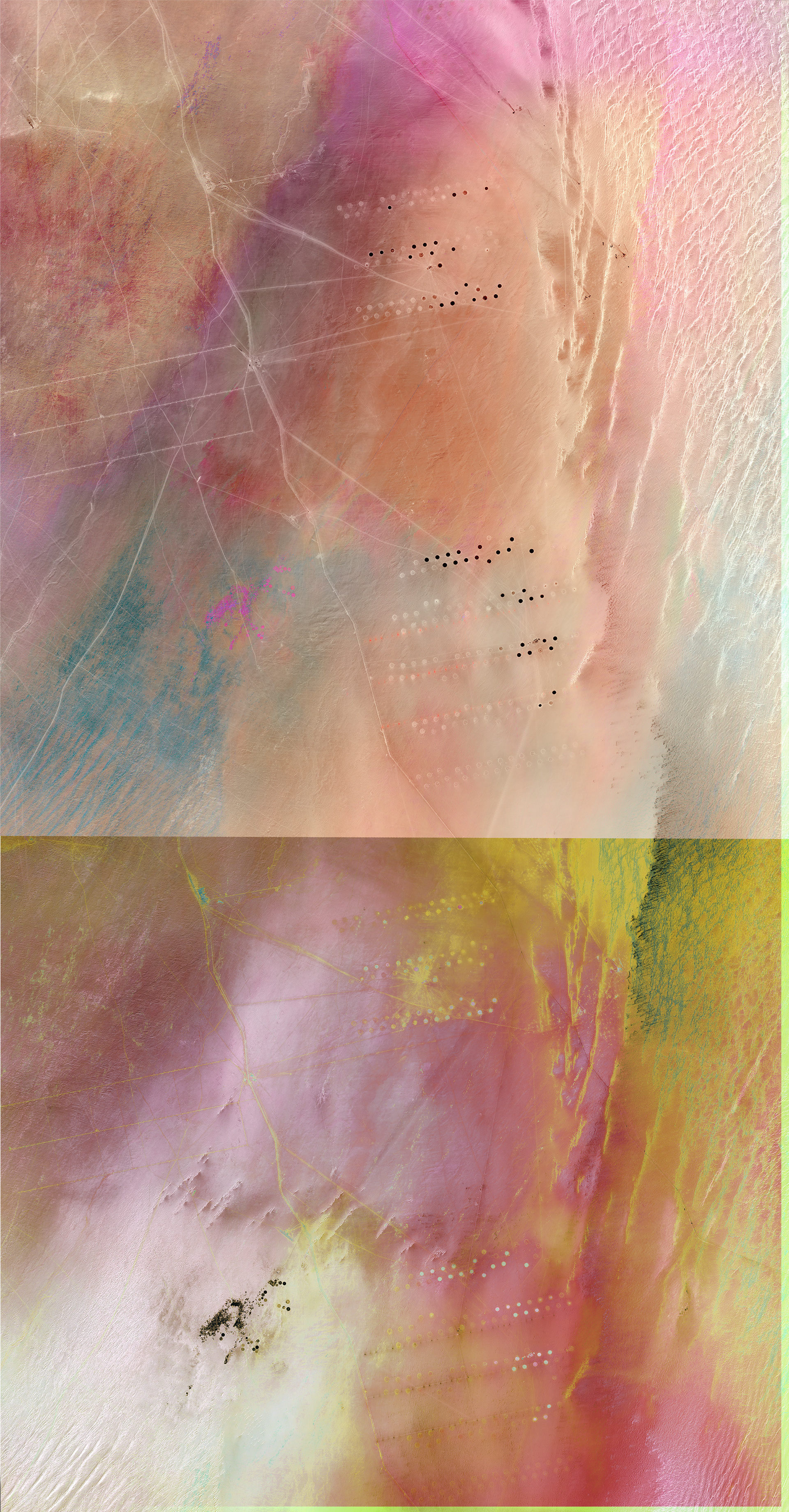
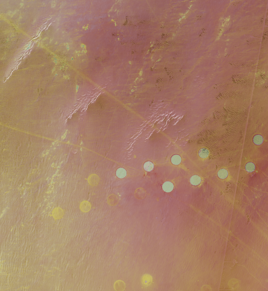
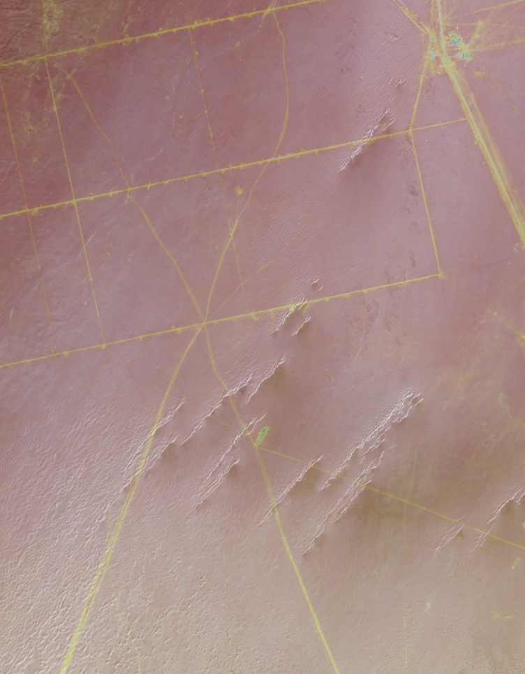
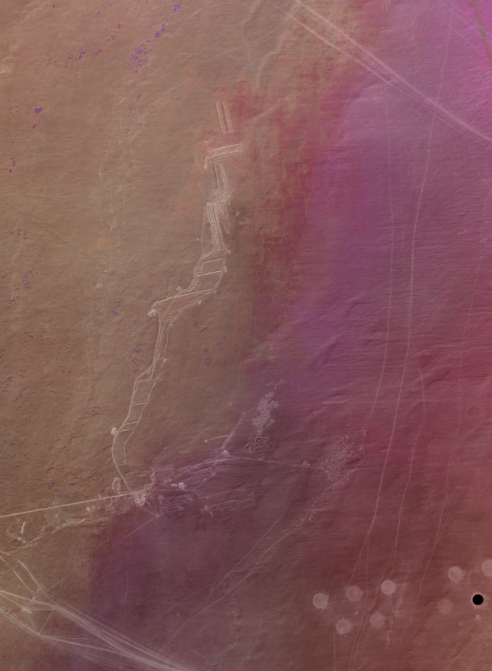
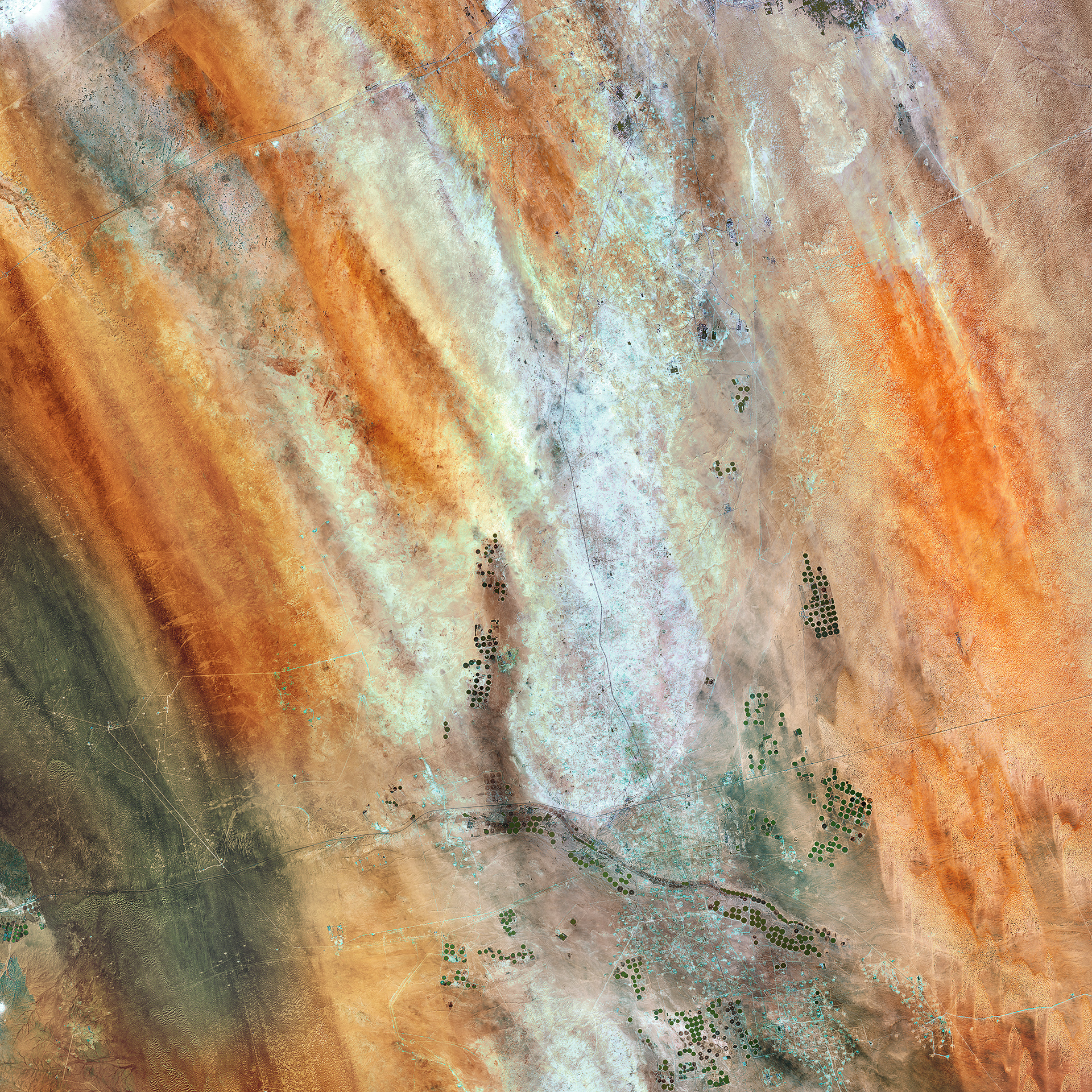
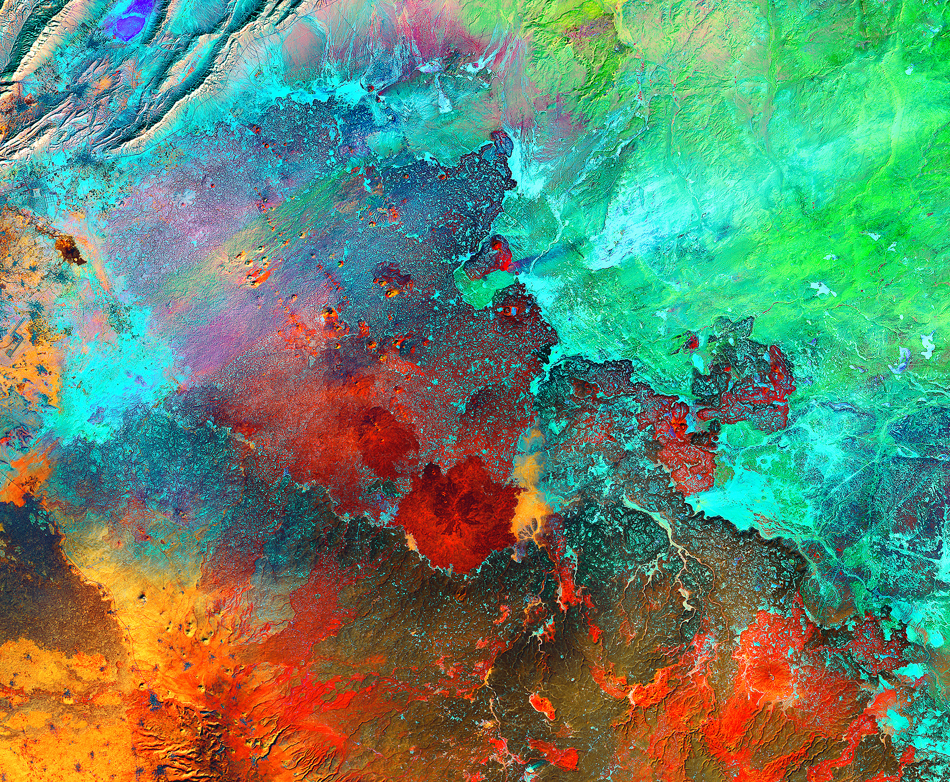
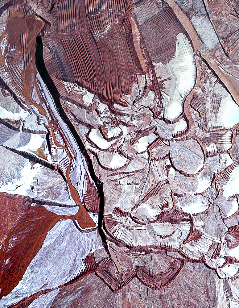
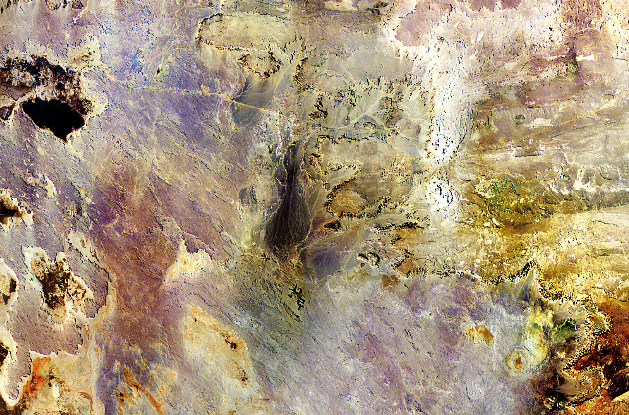
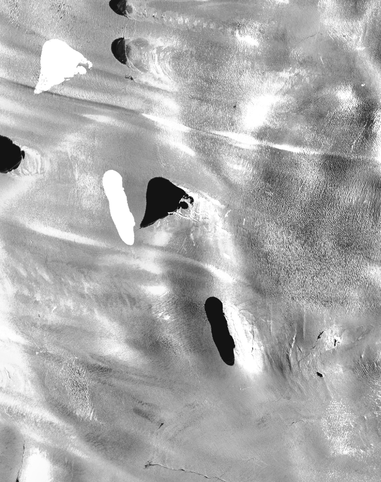
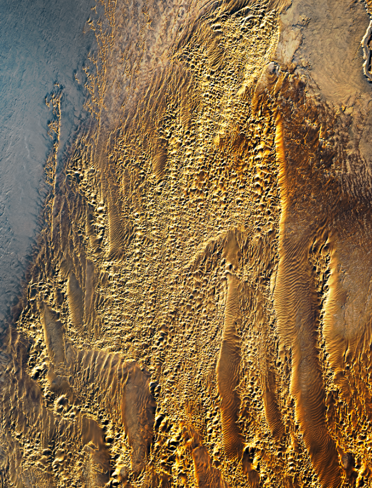
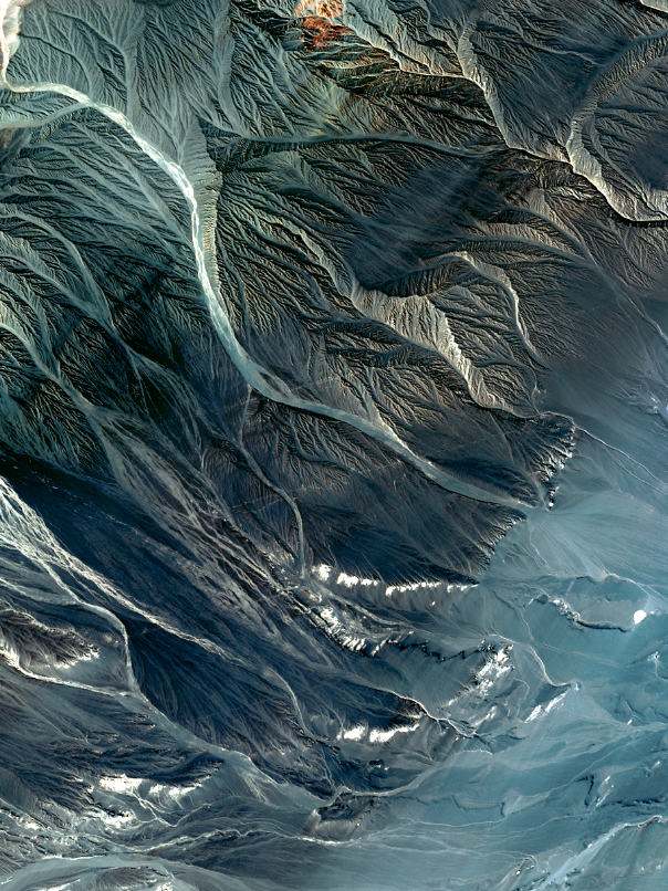
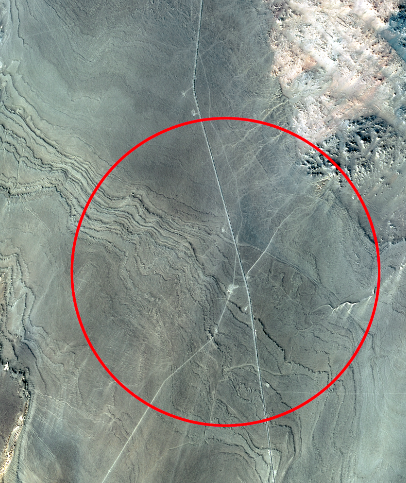
Farms In Libyan Desert
40x70” False Color Satellite Image
2023
Terraforming refers to the process of making inhospitable planets habitable,
unfortunately, humans are remarkably adept at doing the opposite. Thermal
and infrared images are combined in this work to create ghostly and
apocalyptic images of alien-looking landscapes. Farms in the desert of Libya
rely on extensive wells for irrigation, and the roads that connect them span
thousands of miles to reach coveted water.
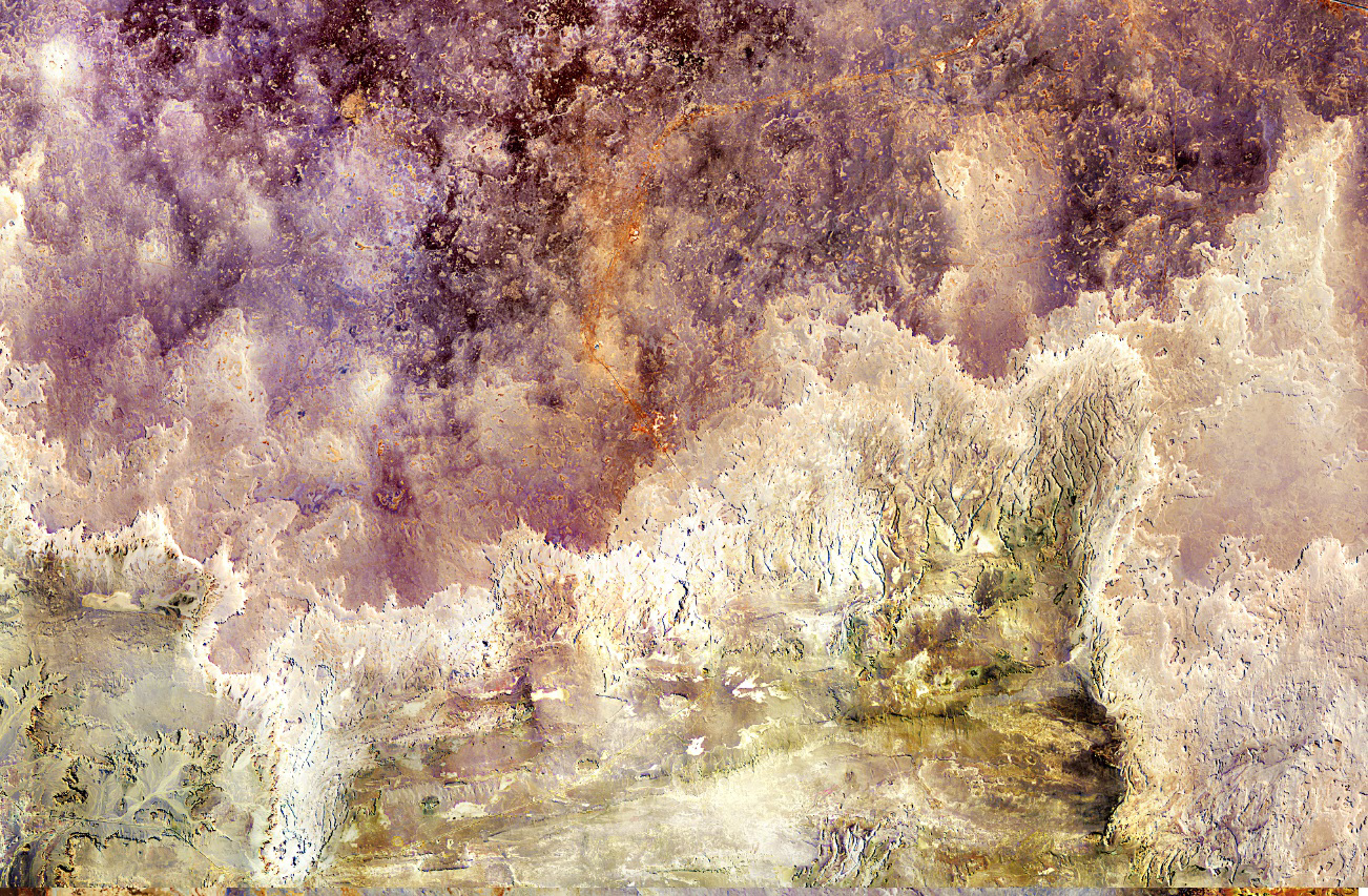

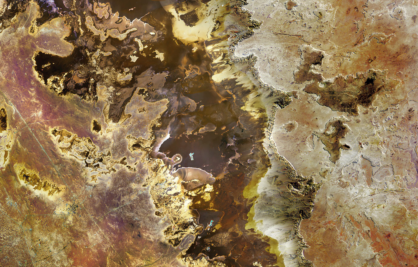
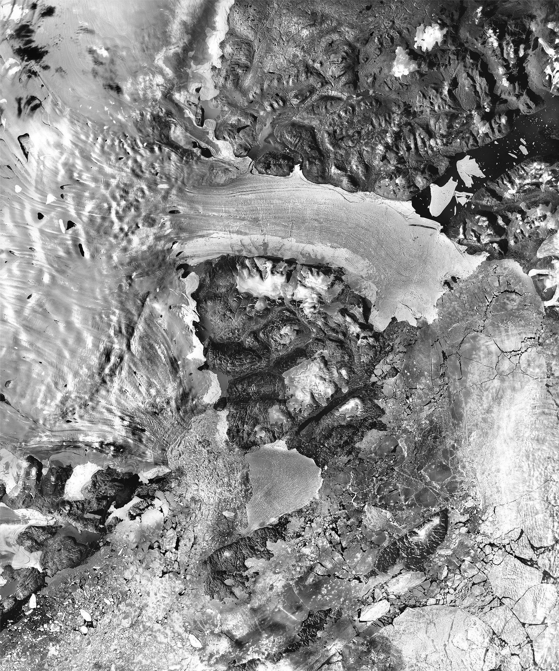
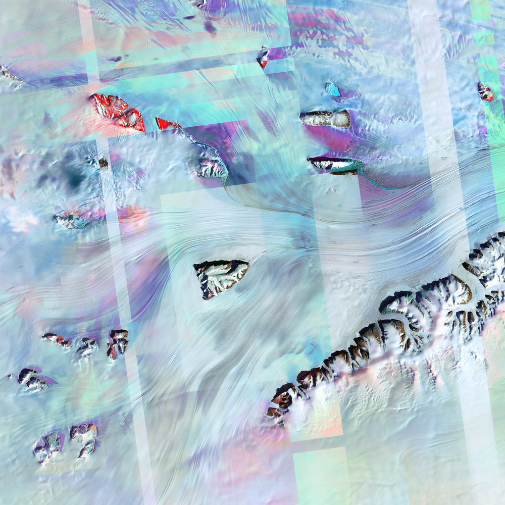
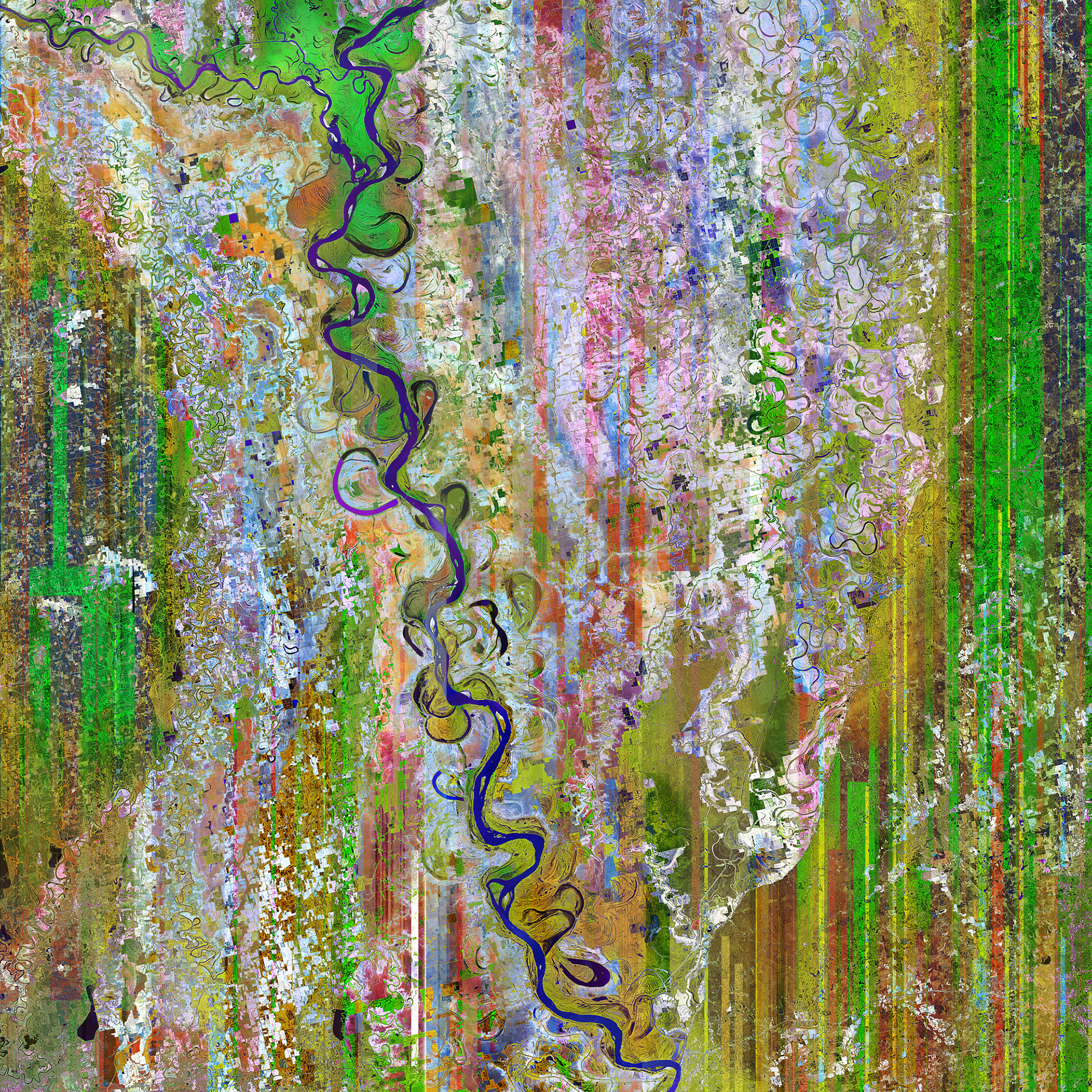
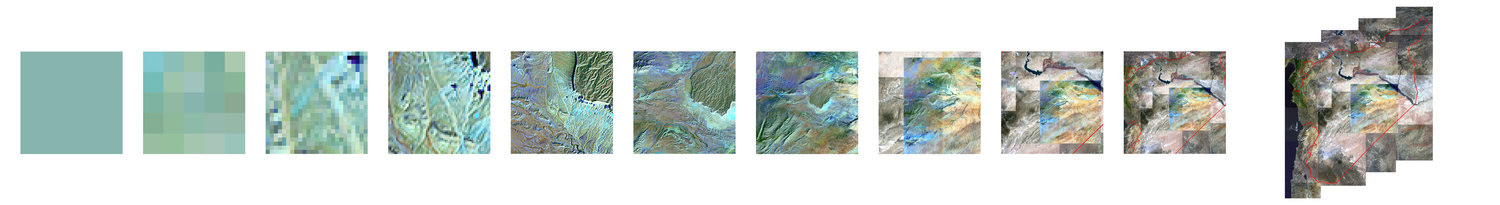
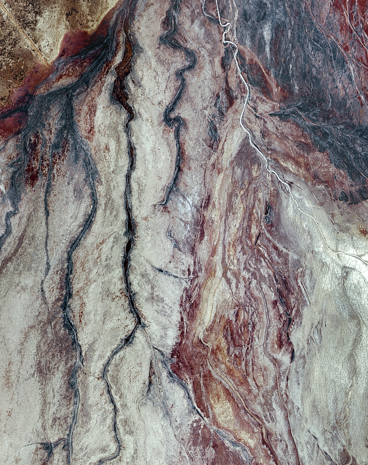
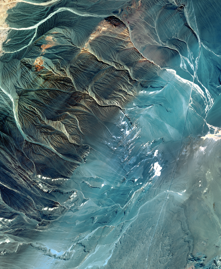
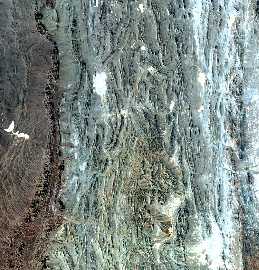
Spheroidal Carbonaceous Particles
40x60” Infrared Satellite Image
2023
Signifiers of the Anthropocene must be globally ubiquitous and novel to the
human age. Ice cores from this glacier contain fly ash, which is not found
in the pre-human planetary record. Using publicly accessible satellite data,
I processed this infra-red image to reflect the scope of how humans have
altered the planet.
human age. Ice cores from this glacier contain fly ash, which is not found
in the pre-human planetary record. Using publicly accessible satellite data,
I processed this infra-red image to reflect the scope of how humans have
altered the planet.
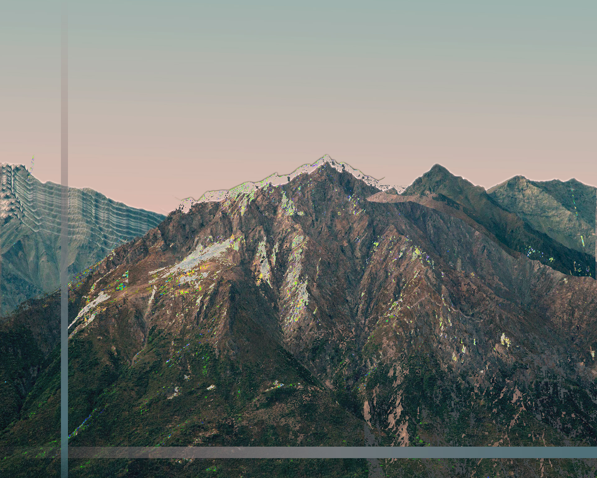
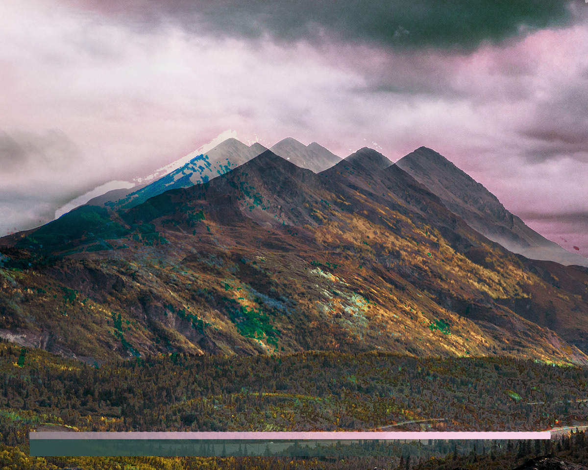
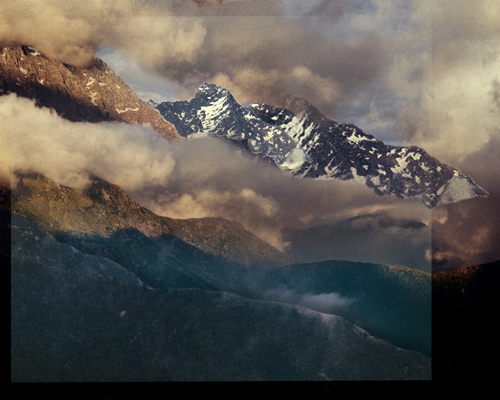
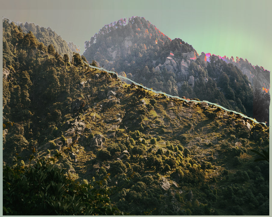
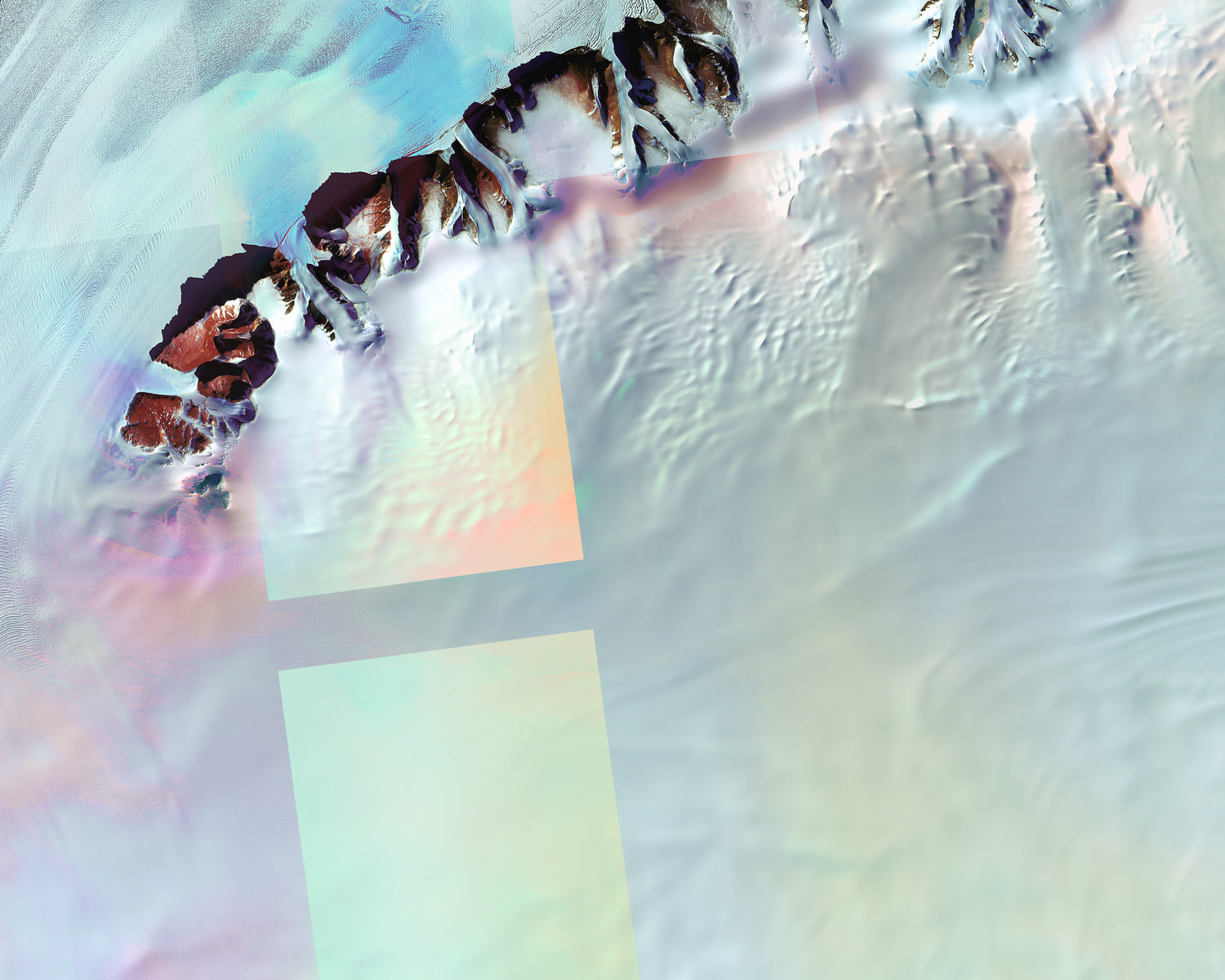
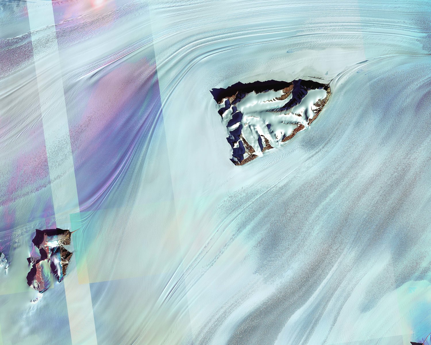
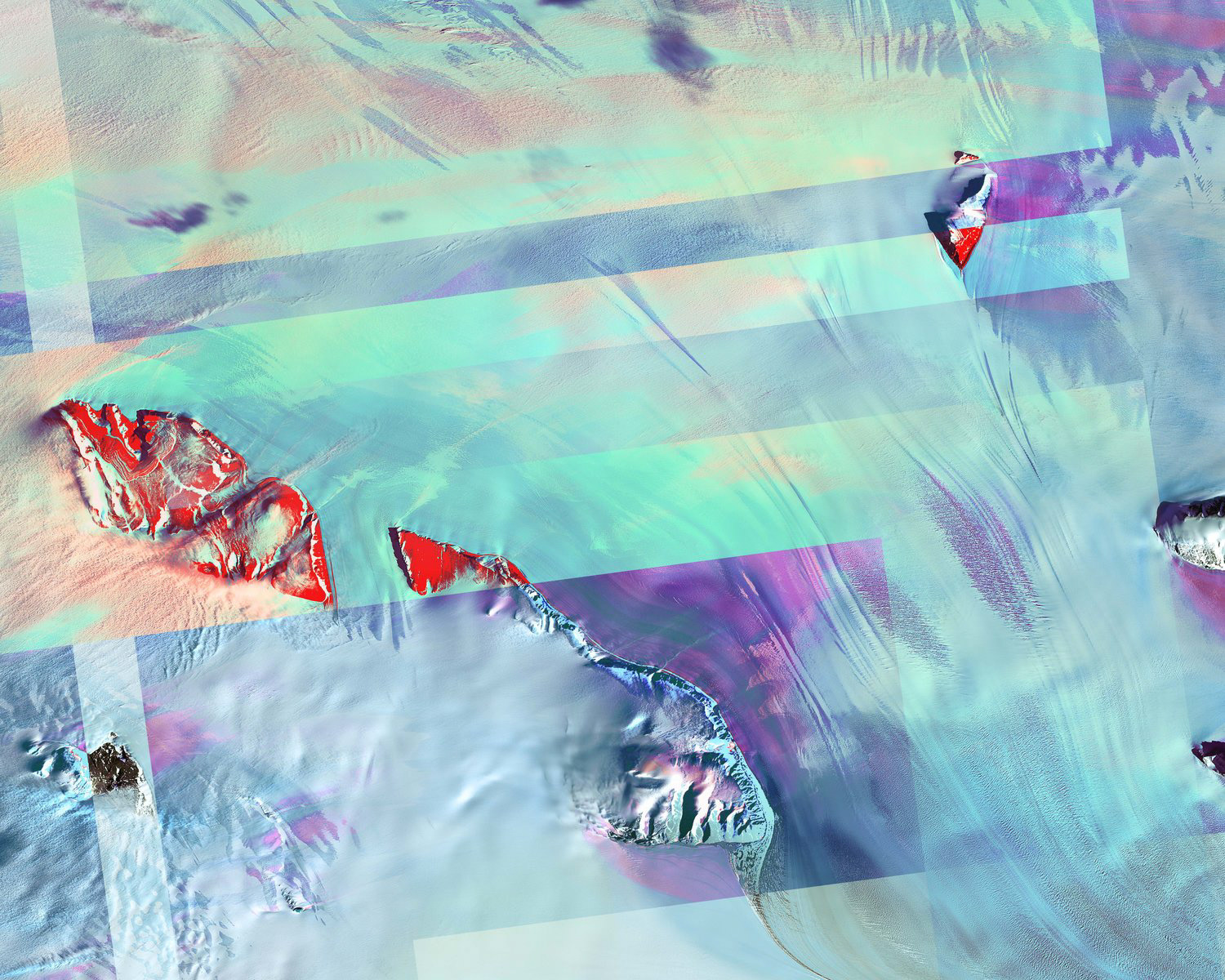
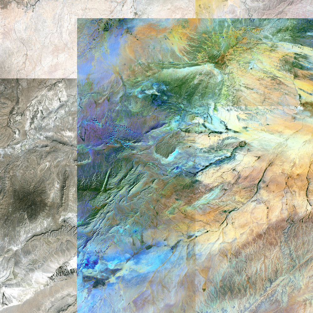
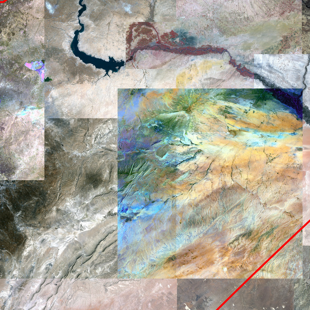
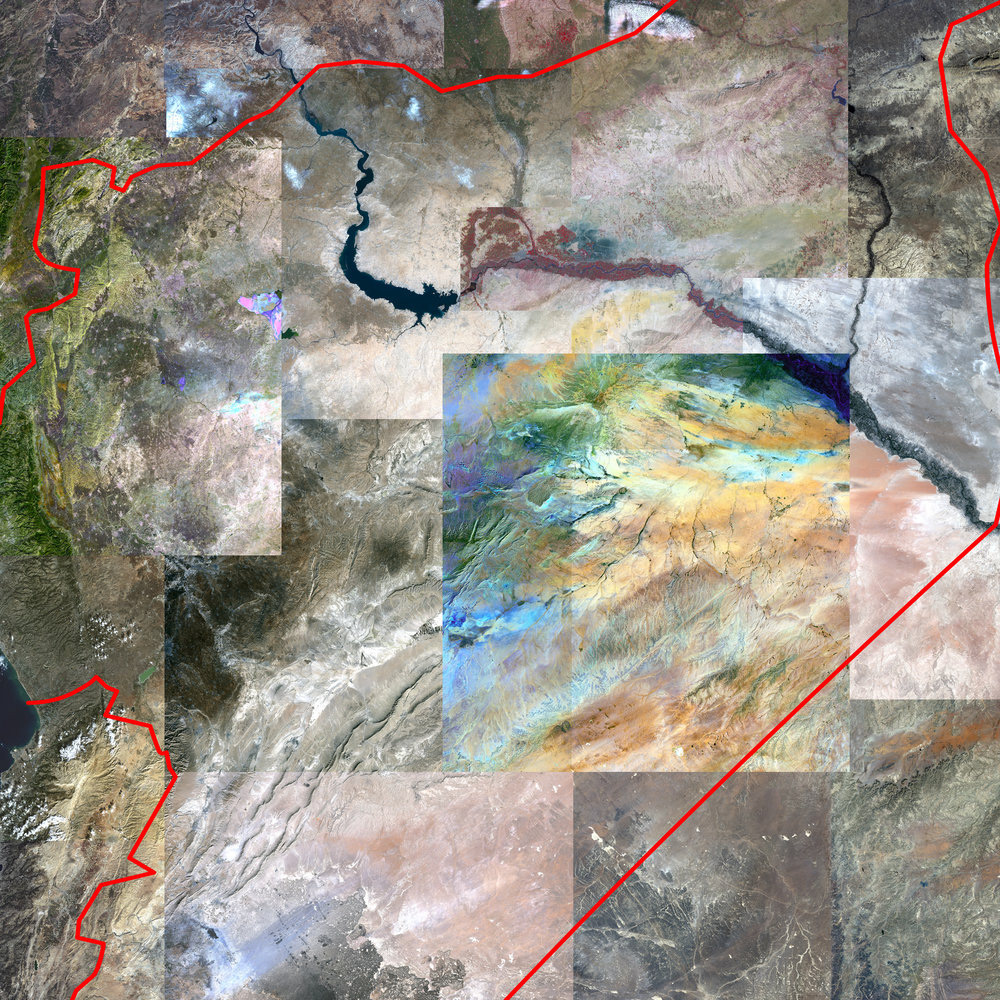
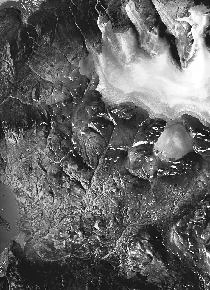
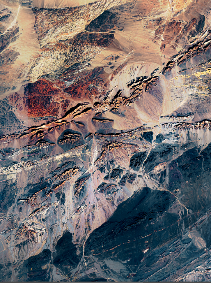
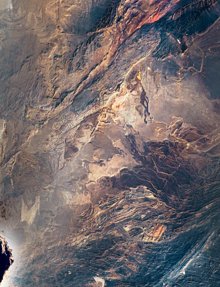
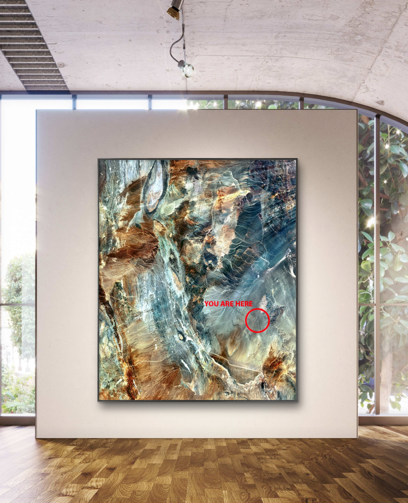
Peak I, II, III, IV
8x10” Digital Image
2023
2023
Manipulated digital images in this series mimic how land is viewed in the eyes
of development. Segregating elements, reorganizing, and altering to fit a new
purpose, this work evokes acts of physical intervention such as mountain top
removal and categorization of land into its useful properties. Images taken in India and Alaska.
of development. Segregating elements, reorganizing, and altering to fit a new
purpose, this work evokes acts of physical intervention such as mountain top
removal and categorization of land into its useful properties. Images taken in India and Alaska.
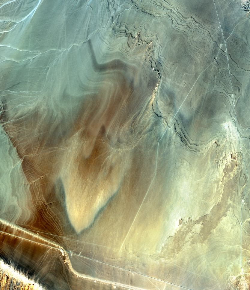
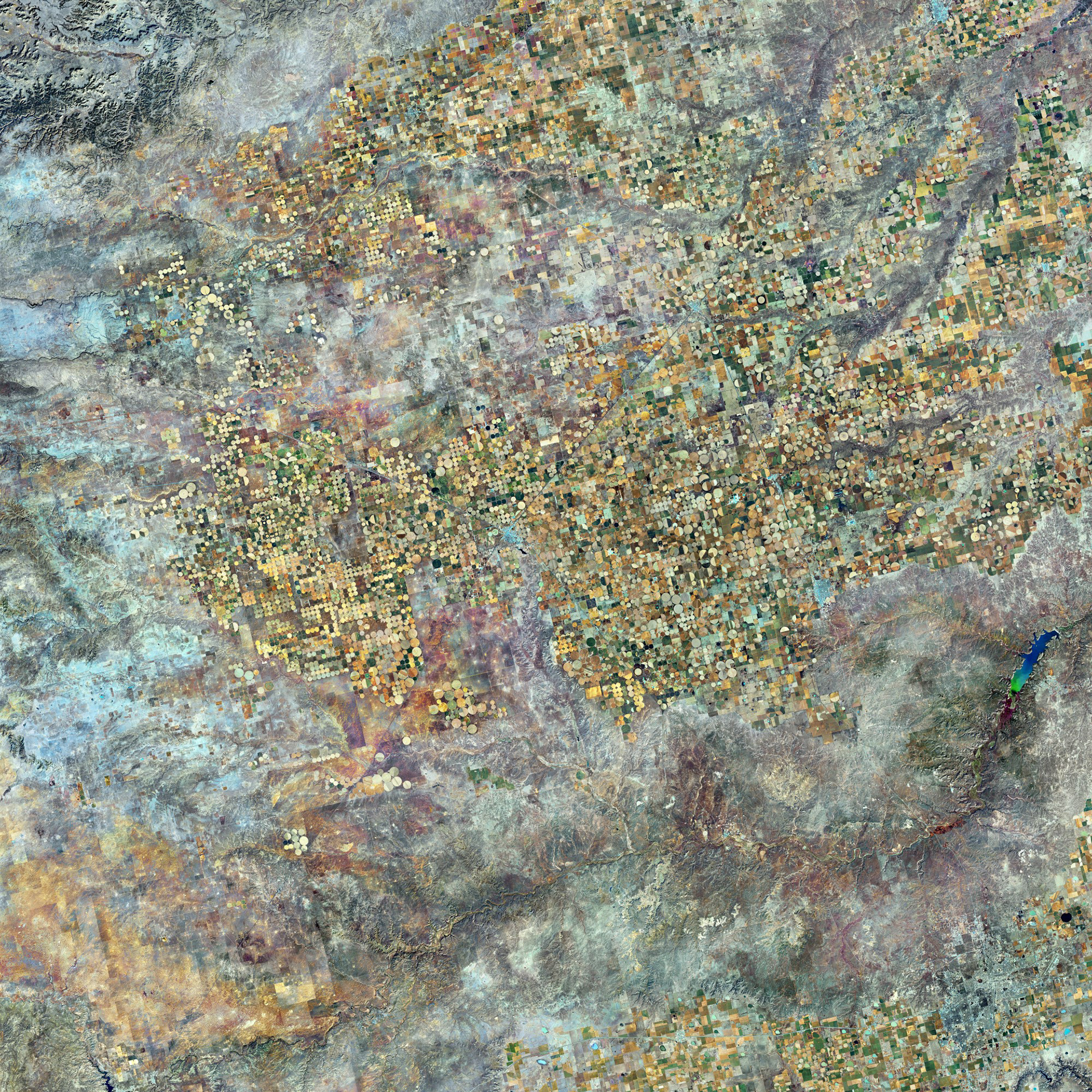
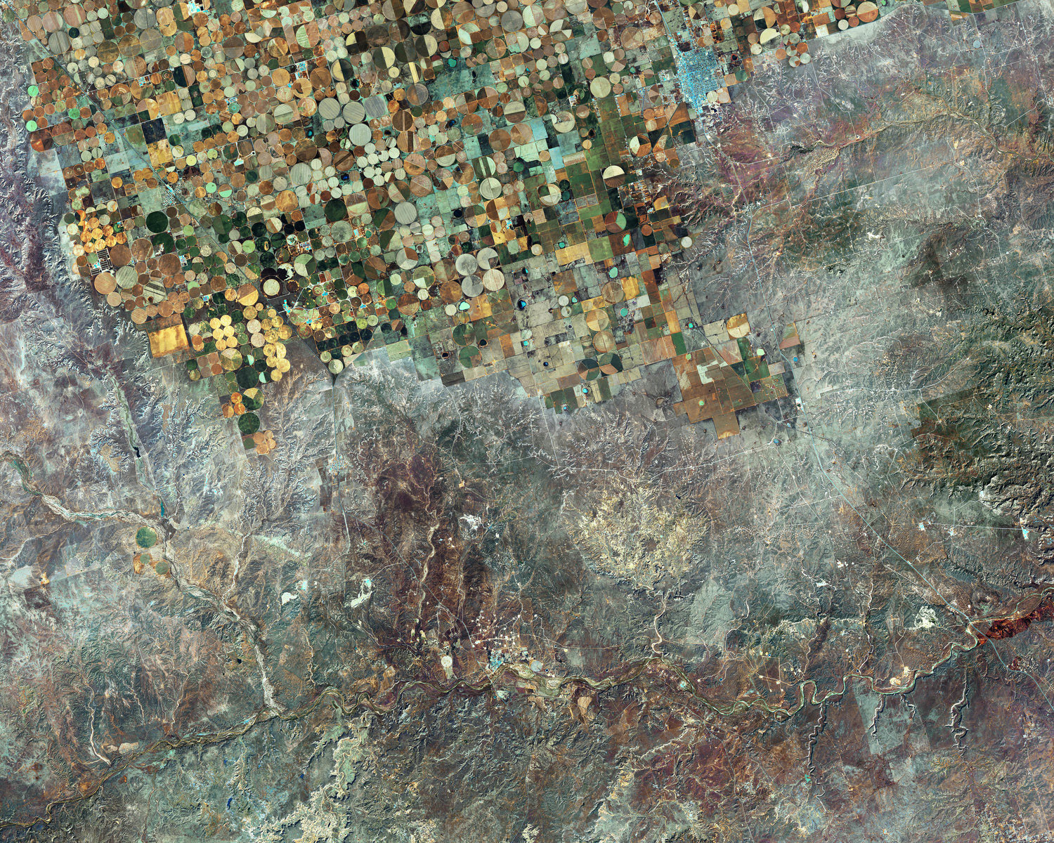
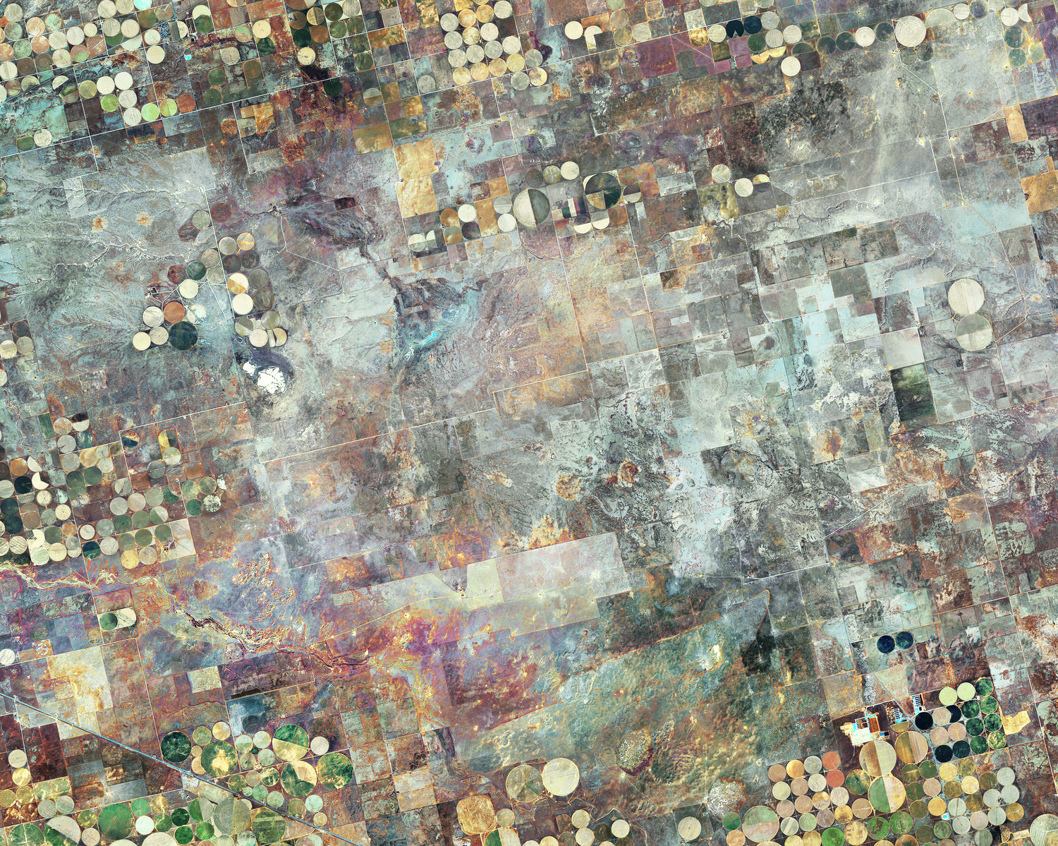
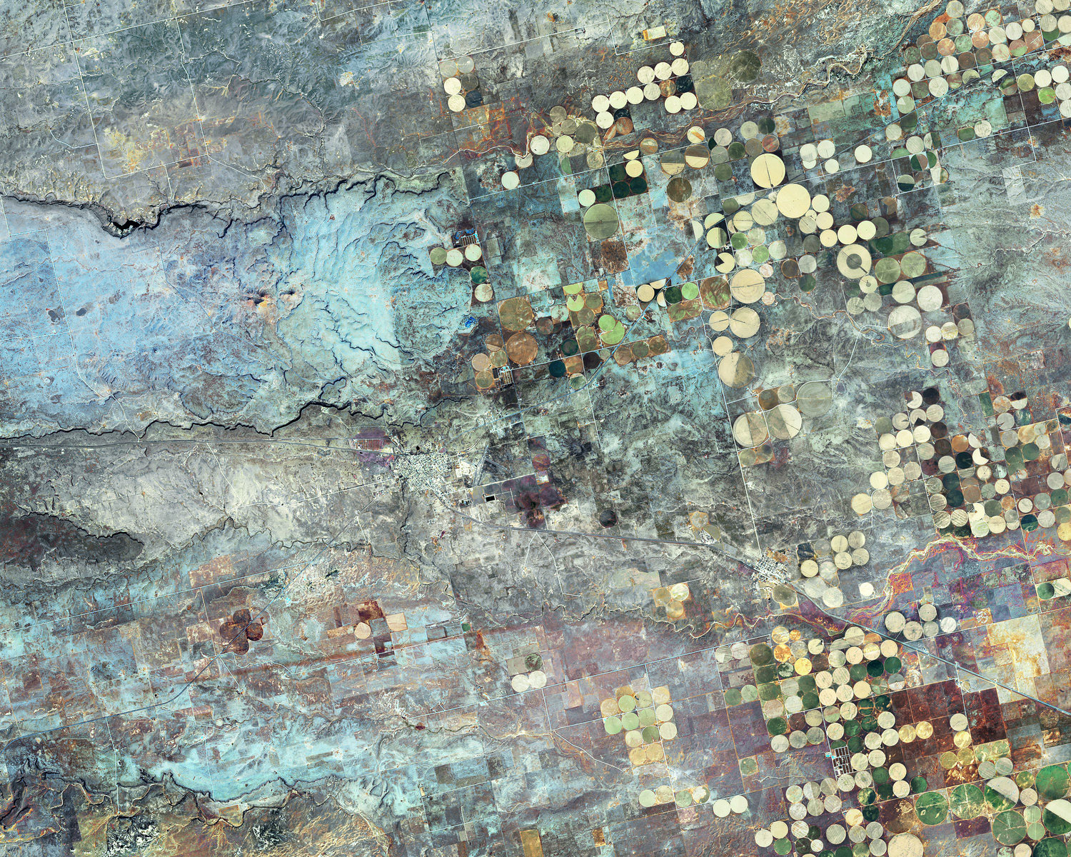
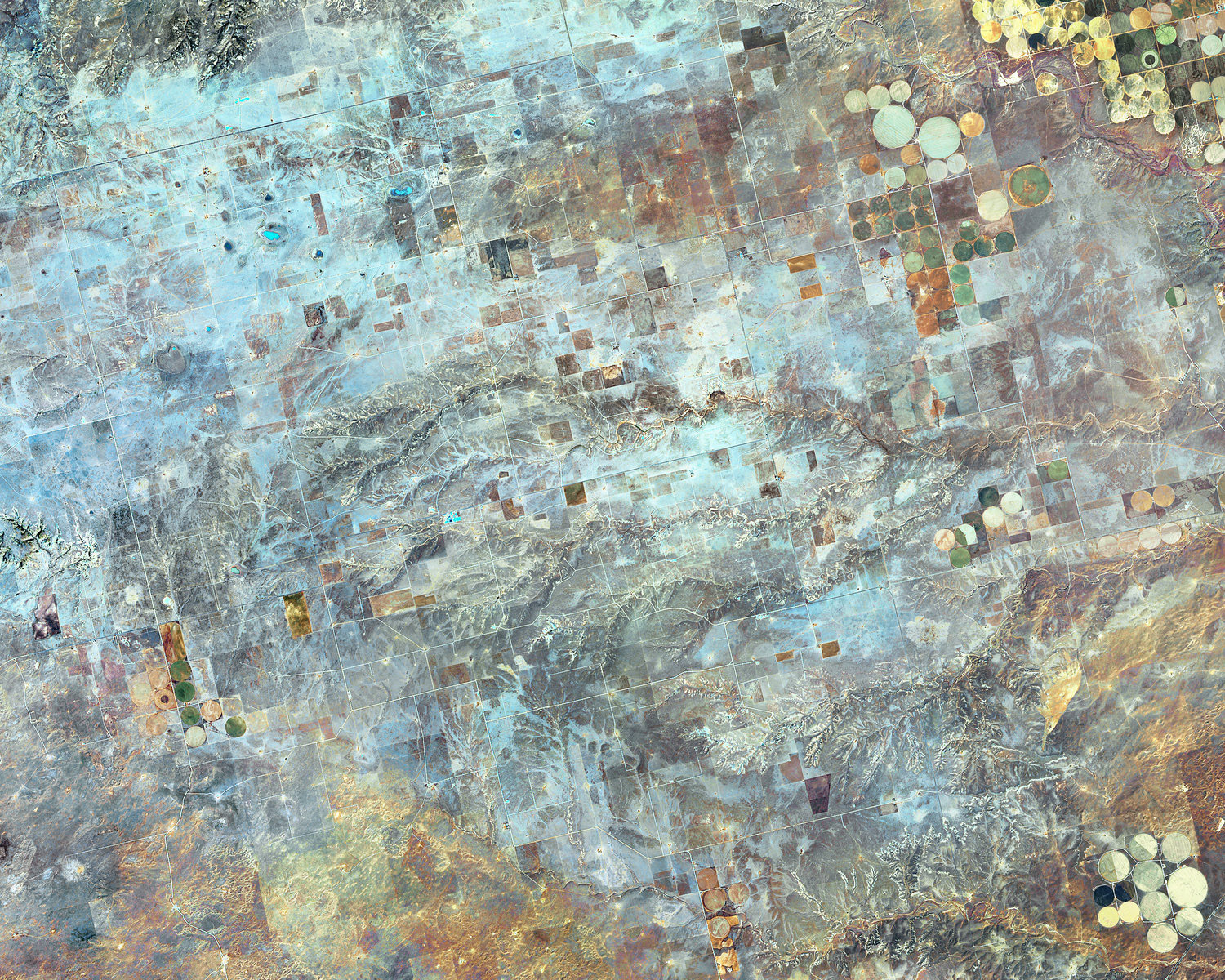
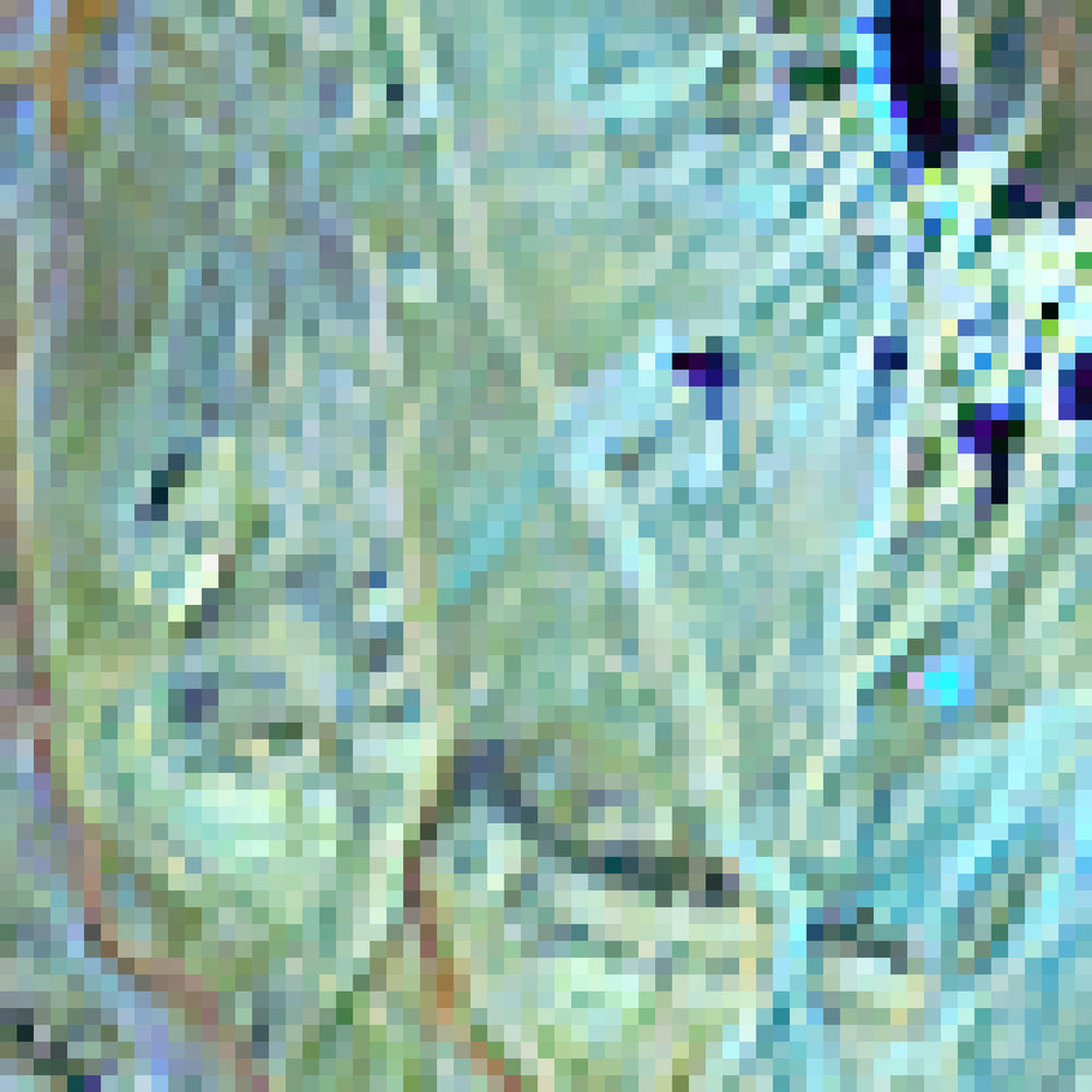
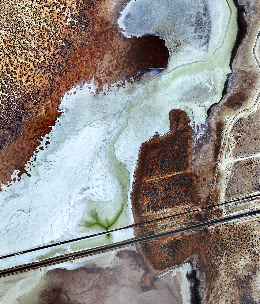
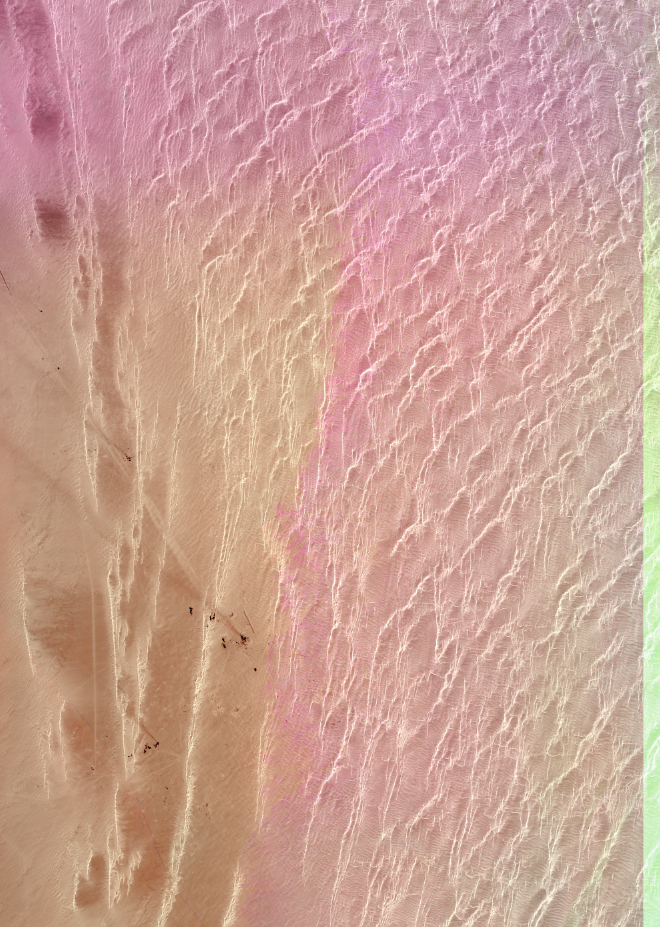
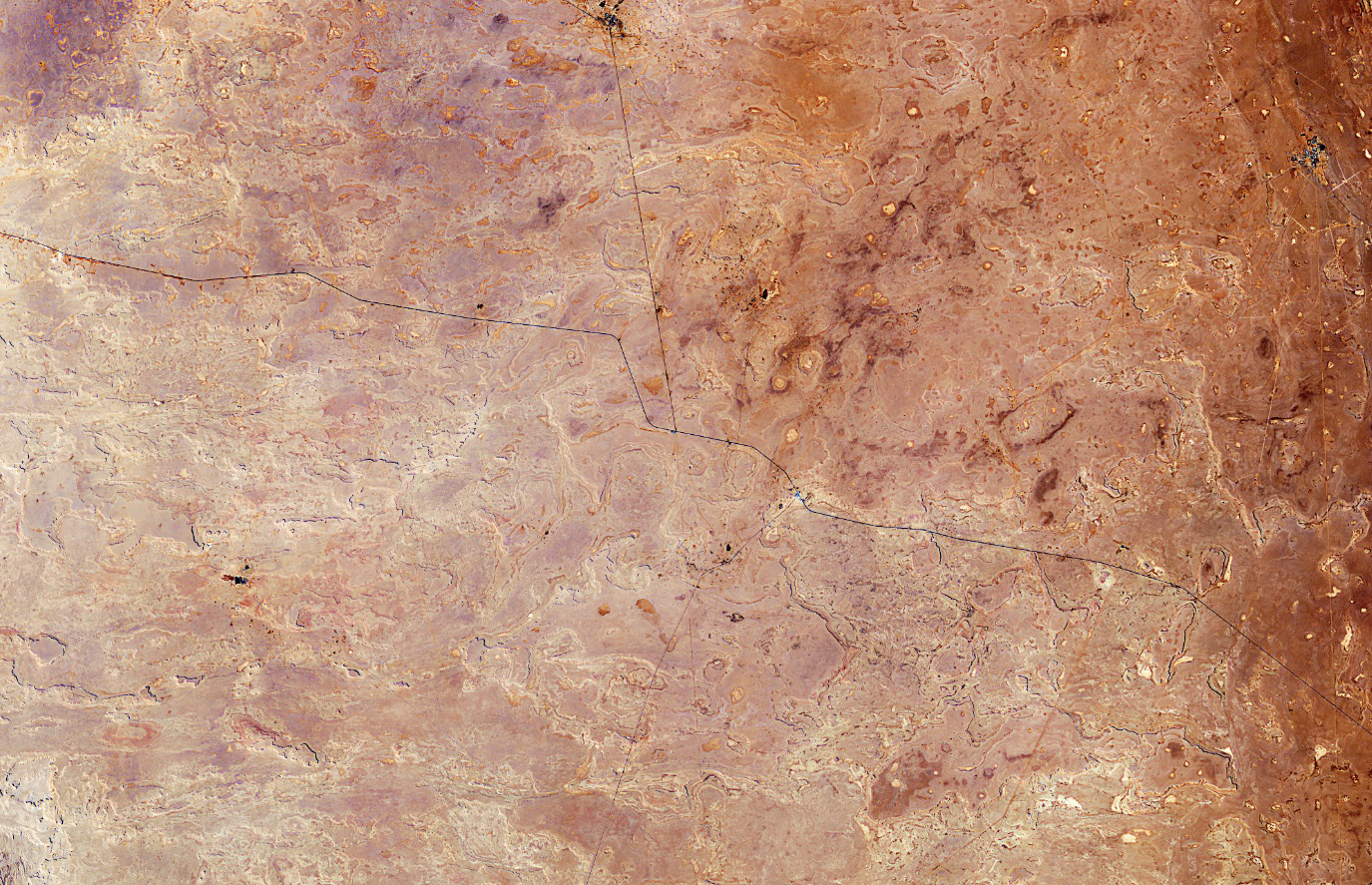
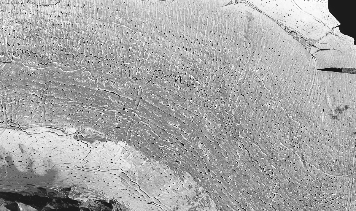
Ogallala Aquifer, Dalhart, Texas, USA
30x30” False Color Satellite Image, Pigment Print Mounted on Dibond
2018
Several wavelengths of light are captured in this remote sensing satellite
image. Thermal, infrared, and visible light images are combined to create a
landscape humans would otherwise be unable to see. The Ogallala Aquifer
provides water to 20% of United States agriculture, but with current irrigation
practices, it will be dry by the end of this century.
image. Thermal, infrared, and visible light images are combined to create a
landscape humans would otherwise be unable to see. The Ogallala Aquifer
provides water to 20% of United States agriculture, but with current irrigation
practices, it will be dry by the end of this century.